Header_logo-0605
Artist’s impression for illustrative purpose only

Revised Recommended Outline Development Plan

San Tin Technopole covers a development area of 626 hectares (ha). Apart from the Loop (87 ha), the development area comprises mainly I&T Park and San Tin Town Centre.

Revised Recommended Outline Development Plan
(Note: The public/private housing as indicated in the plan above is for indicative purpose only. The actual allocation of land for public or private housing use will be determined in due course.)
(Please click here for the Recommended Outline Development Plan promulgated in May 2023)

I&T Park

The majority of the I&T Park is located to the north of San Tin Highway/Fanling Highway, with a portion at the southeastern part of the development area. Underlining Government’s strong commitment to I&T development, the I&T Park and HSITP at the Loop will collectively provide around 300 ha I&T land, comparable to the I&T zone in Shenzhen with a size of 300 ha on the other side of Shenzhen River. Accounting for about half of the total development area of San Tin Technopole, the 300 ha I&T land are capable of accommodating 7 million sqm of gross floor area, equivalent to 17 Science Parks.

Within the I&T Park, connected land parcels of various sizes (including the 20-ha Government land to be released from LMC Control Point when the co-located new Huanggang Control Point commences operation) are designed to meet the needs of I&T facilities and uses of varying scales and purposes. The I&T Park will be served by two cross-boundary rail links, namely the proposed Northern Link (NOL) Spur Line connecting to the future co-located new Huanggang Control Point, with new stations near Chau Tau and HSITP, and the existing LMC Spur Line with LMC Station. The proposed Sam Po Shue Wetland Conservation Park adjoining San Tin Technopole provides a unique wetland backdrop for the I&T Park while creating environmental capacity for its development.

Rendered Illustration of I&T Park

Artist’s impression for illustrative purpose only

Rendered Illustration of I&T Park

Artist’s impression for illustrative purpose only

In close proximity to the I&T Park, three sites near Fanling Highway and the proposed Shek Wu Wai Interchange, and at the southeastern part of the development area are proposed for logistics, storage and workshop uses. The sites may be developed into multi-storey buildings for modern industries or used for open air operation.

San Tin Town Centre

San Tin Town Centre, which is mainly located to the south of San Tin Highway/Fanling Highway, will supply about 50 000 public and private housing units, mostly within 500m walking distance from the railway stations. It is planned as an integrated neighbourhood with comprehensive public and community facilities. Two “mixed use” zones at the railway stations, and the cultural and recreational complex in the central part of San Tin Town Centre will be the landmarks of the area.
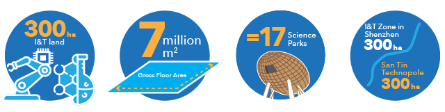
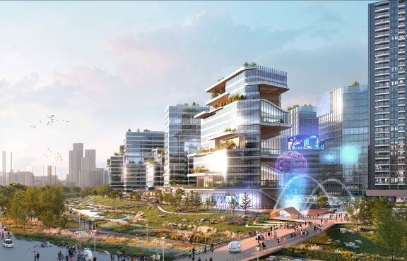
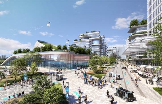
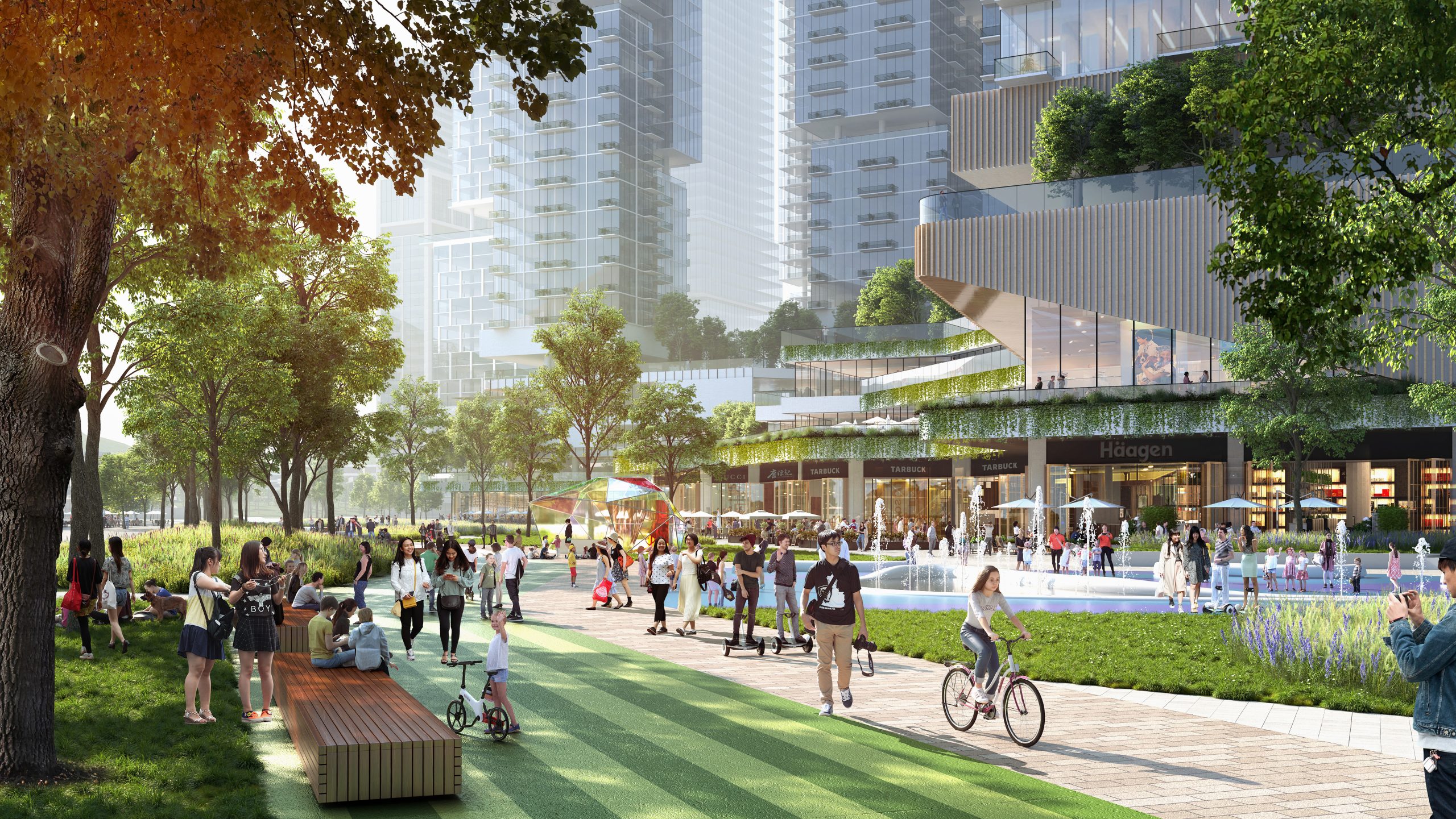
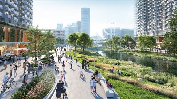
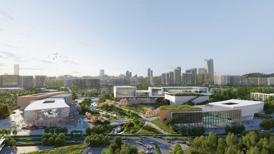
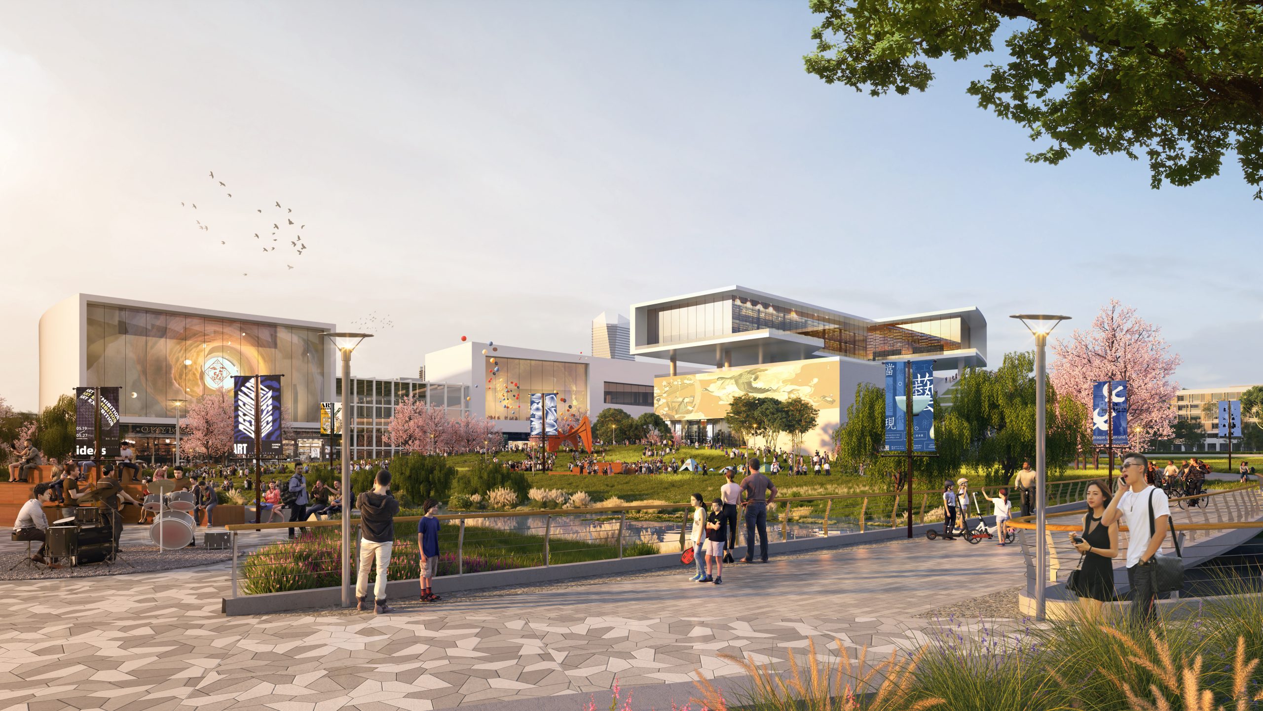
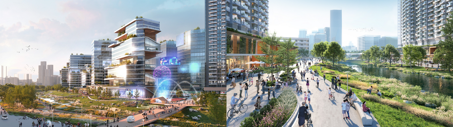
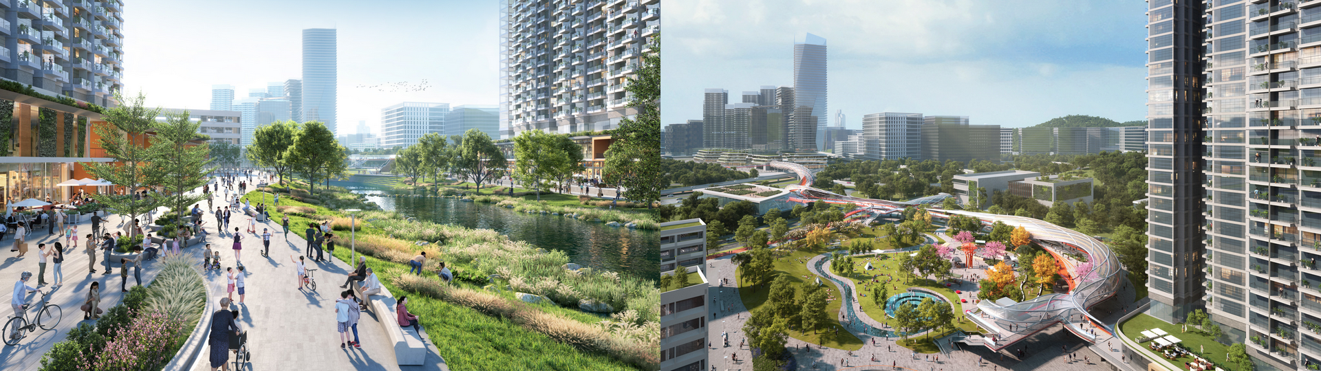
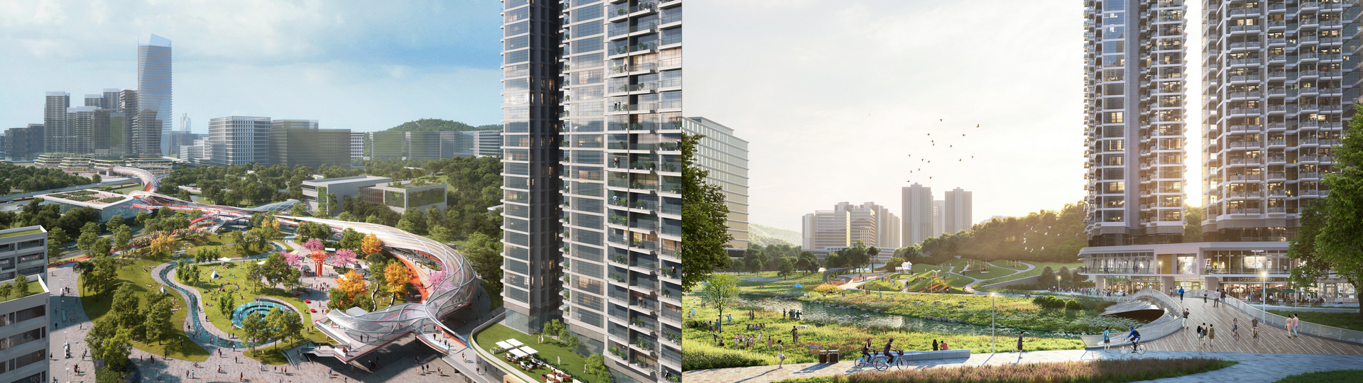
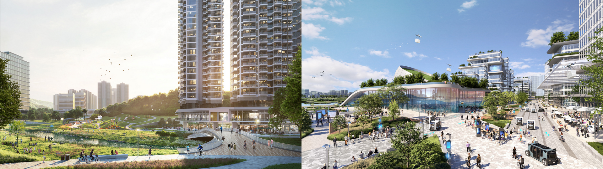
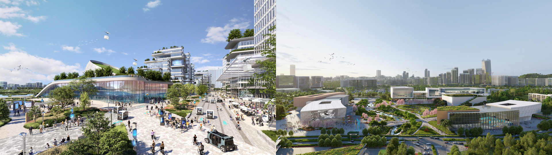
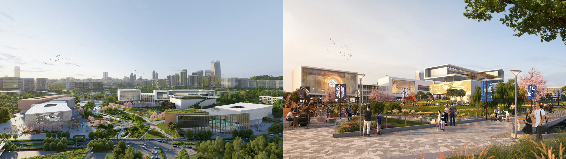
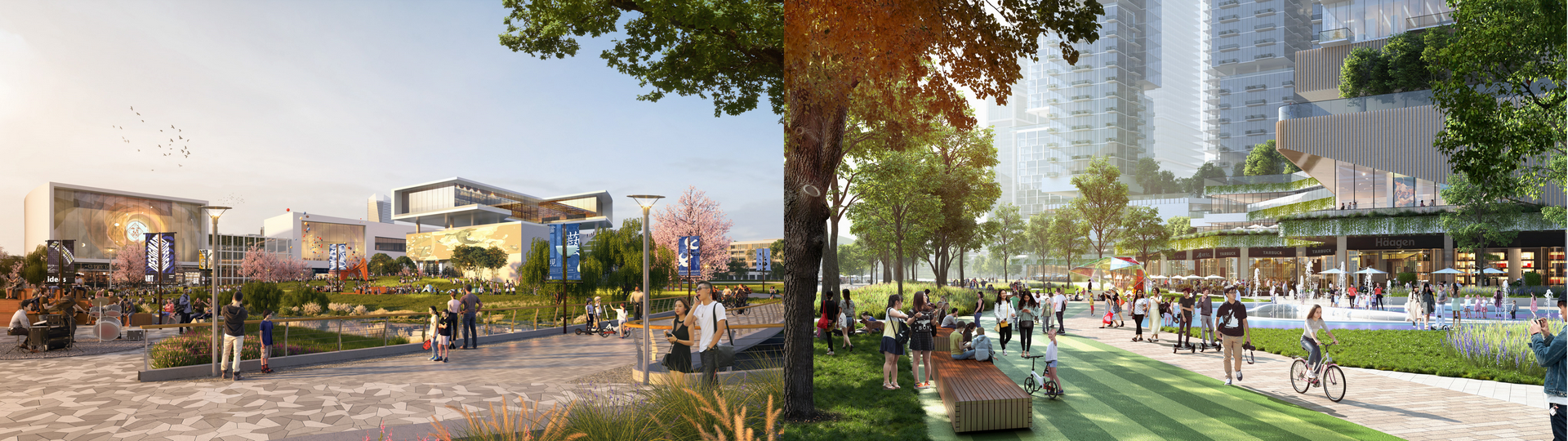
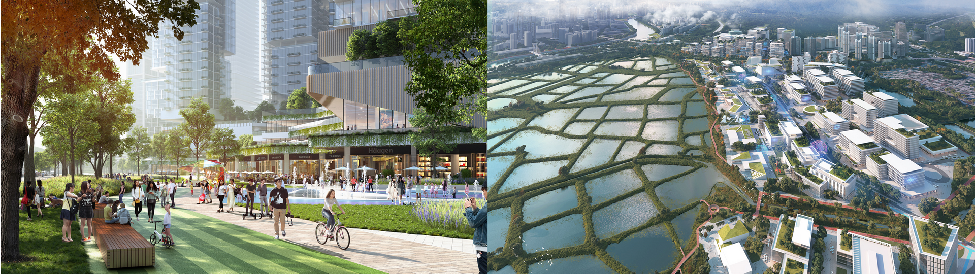
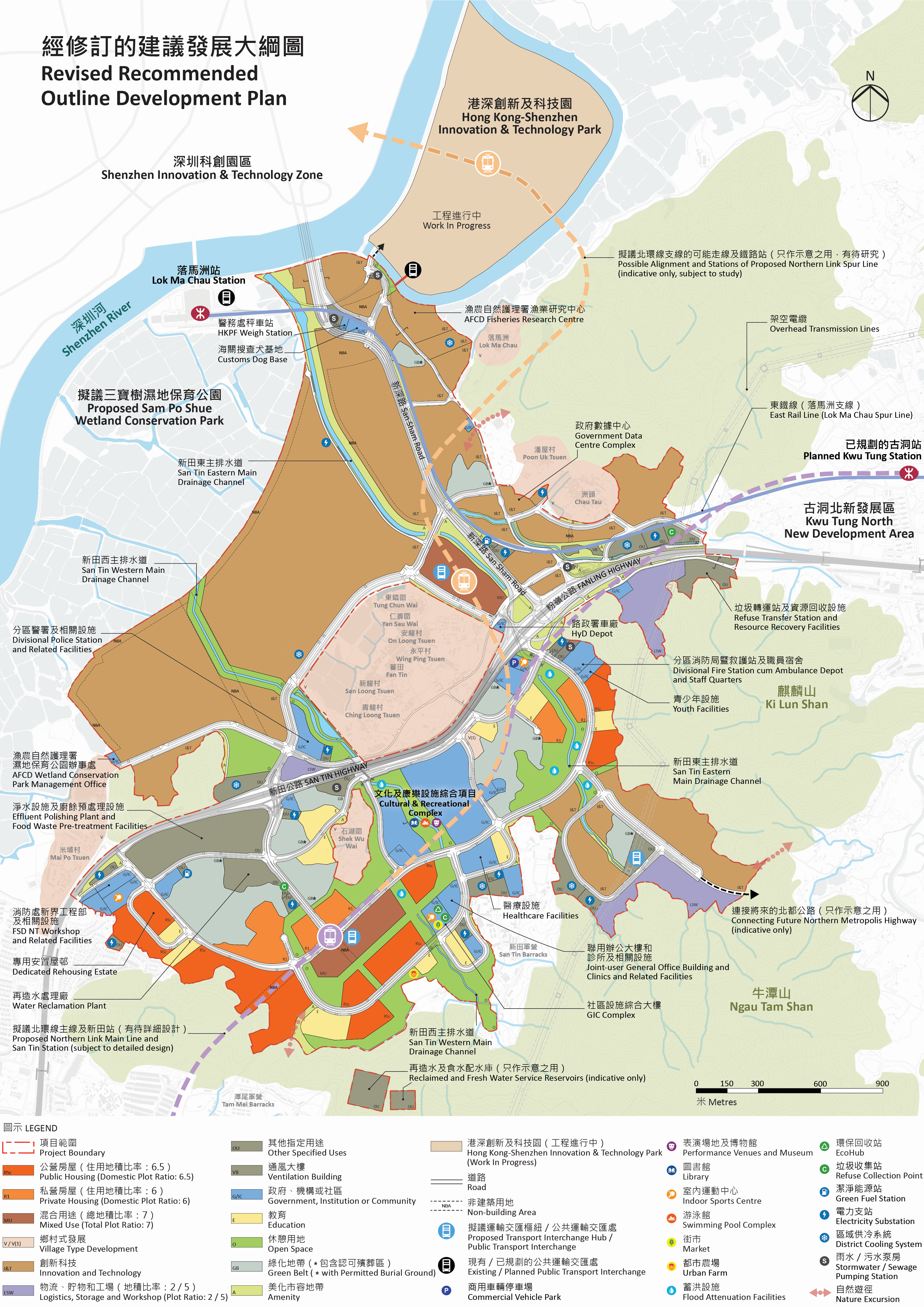
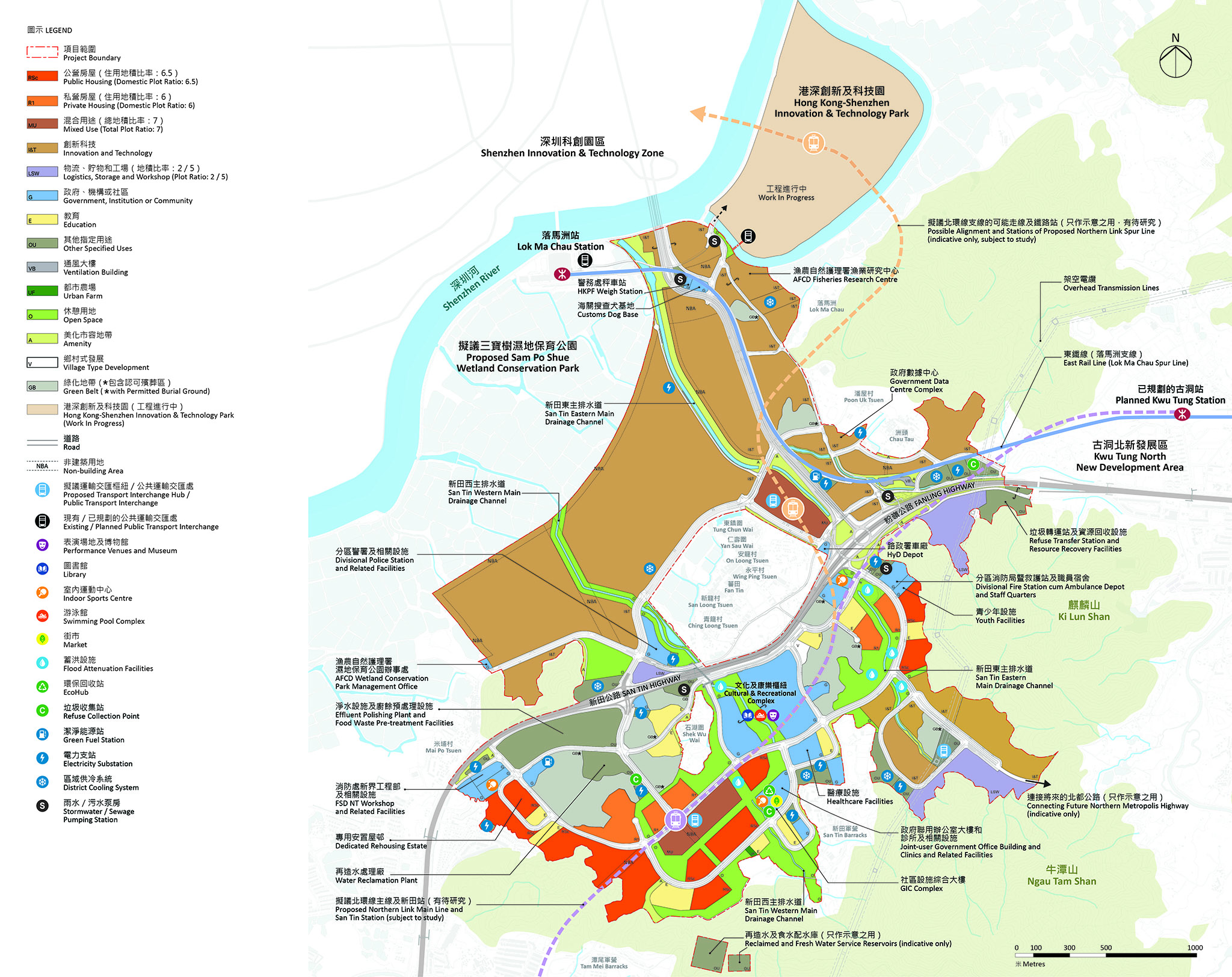
Encompassing the proposed San Tin Station with a transport interchange hub, San Tin Town Centre West is characterised by a mixed use development (comprising residential developments, offices, hotels, retail, dining and entertainment facilities) which is surrounded by public/private housing, and government, institution and community (GIC) facilities. The proposed developments near the future railway station are mostly high density developments, which are knitted together with low to medium-rise GIC facilities by a network of open space.
Rendered Illustration of San Tin Town Centre

Artist’s impression for illustrative purpose only

San Tin Town Centre East is located along the San Tin Eastern Main Drainage Channel to be revitalised. It is mainly composed of residential developments and GIC facilities. The drainage channel will be revitalised and integrated with the Riverside Park to enhance robustness of flood retention capability. The Riverside Park and the shopfronts on the lower floors of the residential blocks will create a leisure ambience. Pedestrians and cyclists could make use of the iconic landscape deck across San Tin Highway to reach the proposed railway station near Chau Tau with transport interchange hub. A mixed use development comprising residential developments, offices, hotels, retail, dining and entertainment facilities is planned in the area.
Rendered Illustration of Living Community at Riverside Park

Artist’s impression for illustrative purpose only

Rendered Illustration of Iconic Landscape Deck

Artist’s impression for illustrative purpose only

Key community and living support to the residential and working population will be provided in the central portion of San Tin Town Centre. The San Tin Western Main Drainage Channel will be revitalised as a landscaped river course. On its two sides there is a landmark Cultural and Recreational Complex with major performance venues, museum, library, swimming pool complex, and flexible public and event spaces. Sites are also reserved for educational facilities, healthcare facilities, youth facilities, a GIC complex (including market, indoor sports centre, ecohub, etc.), clinics, Government joint-user office building, police station, fire station cum ambulance depot and other essential infrastructures.

Rendered Illustration of Cultural and Recreational Complex

Artist’s impression for illustrative purpose only

Rendered Illustration of Cultural and Recreational Complex

Artist’s impression for illustrative purpose only

Market
Clinics
Library
Performance Venue
Indoor Sports Centre
Government Joint-user Office Building
Museum
Swimming Pool Complex
©2024
Civil Engineering and Development Department and Planning Department
All Rights reserved